By Arturo Morales Tirado
San Miguel de Allende’s contemporary cosmopolitan society and its local Mexican population, with the rural area and area of physiographic and cultural influence, more intuitively than knowingly, has established itself and makes its project of life in this authentic, unique, unrepeatable, and exceptional natural and cultural landscape. I am referring to some of the wonders of this Inland Frontier (Frontera de Tierra Adentro) and its geological evolution over the last 50 million years and its cultural evolution over the past 2,500 years.
Geologically, geographically, and physiographically, we are in the borderlands between volcanic Mesoamerica to the south and semi-desert to desert Aridoamerica to the north.
San Miguel is near the active tectonic margin where the Cocos tectonic plate, formed about 25 million years ago, to the south and southwest of us, subducts below the North American tectonic plate. The subduction process has resulted in the TransMexican Volcanic Belt (TMVB), which stretches across the center of Mexico. In the area of San Miguel, the TMVB presents as the San Miguel de Allende Volcanic Field and includes four volcanoes: Zamorano to the east in the state of Queretaro, Támbula-la Joya straddling the border of Queretaro and Guanajuato, San Pedro to the south of San Miguel and east of Comonfort, and Palo Huérfano (known locally as Los Picachos) immediately to the south of San Miguel. The community of Alcocer is nestled in the northern flank of this volcano.
Prior to the end of the last great glaciation approximately 10,000 years ago, large mammals inhabited the lands of this region. As the glacial period ended, many of these animals were trapped in ravines and waterways, their fossil remains preserved in the land now between the municipalities of San Miguel de Allende and Dolores Hidalgo. This area now constitutes a paleontological zone of more than 5,000 hectares (12,300 acres) and contains older marine fossils dating back 25 to 50 million years old, and megafauna fossils such as mammoth, gomphotheres (large, elephant-like mammals), giant armadillos the size of a car, saber-tooth tiger, and more. The paleontological zone contains more than 36 fossil beds constituting the largest megafauna fossil area in North America.

The first settlers in the region, some 2,500 years ago during the Mesoamerican Formative or Preclassic period (ca. 2,500 B.C. to A.D. 250), practiced agriculture on the banks of the San Damián, Tlaxcalilla, and Laja rivers—previously called San Miguel—and other tributaries. The inhabitants were part of the Chupícuaro cultural tradition and marked the human presence of the first agricultural communities of this Inland Frontier region. The proto-Toltec cultural tradition then thrived in our Inland Frontier region during the Mesoamerican Classic period (ca. A.D. 250-900). The proto-Toltec culture—perhaps predecessors of the current Otomí people—built urban, military, ceremonial, and other mixed-use centers, which today constitute an inventory of more than 90 archaeological sites. The sites are part of those registered by Luis Felipe Nieto Gamiño in 1988, constituting an Inland Frontier archaeological territory of more than 7,000 hectares (17,300 acres). By the way, at least four of these archaeological sites are in the current urban area of San Miguel de Allende.
In the Mesoamerican Post-classic period (ca. A.D. 900-1521) and until the arrival of the first Spaniards with their indigenous allies from other ethnic groups, the territory of the Frontera de Tierra Adentro in the region of San Miguel was inhabited by at least four ethnic groups—the Copuces, Guamares, Guaxabanas, Pames—of the 12 that were collectively called the Chichimecs by Nahua-speaking culture to the south. These people were expelled from their original territories by the Spanish during the Chichimec War, which lasted for more than 50 years. Thus, the local Chichimec people retreated to the mountains and the margins of the agricultural territories and potential pastures that the Spaniards would use for crops and the introduction of grazing cattle of European origin.
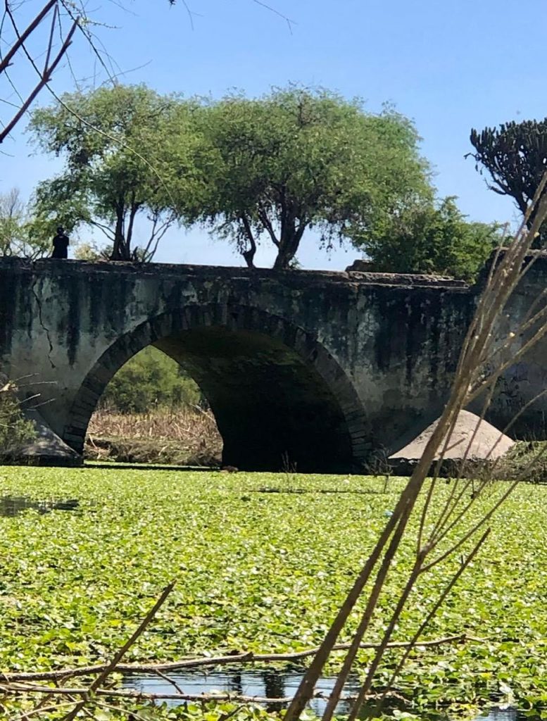
Starting in 1535, with the arrival in New Spain of the first viceroy, Antonio de Mendoza, and before the remains of metamorphic marble, igneous quartz, and other precious-metal producing rock, the traces of the first European road in America began: the Camino Real de Tierra Adentro. In the second half of the 16th century, it would extend 2,600km along its main axes, from Mexico City to Santa Fe, New Mexico, passing by Santiago de Querétaro, San Miguel, Guanajuato, and Zacatecas, among others. From this settlement process and during the three centuries of domination by the Spanish empire, more than 300 Indian chapels, the remains of more than 30 haciendas, more than 20 sites with granaries or barns, hundreds of waterwheels, dozens of stone water tanks and dams and reservoirs, plus forts, inns, cattle ranches, wells and watering structures, and more were generated in our region of the Inland Frontier.
The abandonment of properties and lands due to the plot for Mexican independence from Spain and the first insurgent army and the later influence of dictator Porfirio Díaz Mori, would mark the remodeling of part of the territory, including the railways, among others.
We are privileged to live in a territory of such heritage with exceptional natural and cultural value. It is treasured for its own worth as the natural and cultural landscape of the Inland Frontier and is typical of what is characterized by UNESCO. In the face of excessive and disorderly urban development, our minimum responsibility is to protect it and enhance this exceptional universal wonder.


